Crosstimbers at draper are the closest .. The red trails and green and grass track are for the ATVs.. The trails are always closed when it rains heavy to keep from ruining the trails.. It usually opens back up within 2 says of heavy rains. I also like Lake Murray, and Big Red... its usually just on the weekend now i think... Heard good things about the still water 500 but never been..
You are using an out of date browser. It may not display this or other websites correctly.
You should upgrade or use an alternative browser.
You should upgrade or use an alternative browser.
This site may earn a commission from merchant affiliate
links, including eBay, Amazon, and others.
Depending on your ATV, there's a place in El Reno called Angel Ridge that has a few tracks, and a couple trails. Like I said, depending on your ATV though, tracks being more for a sport ATV rather than a utility one...
During the summer, there are alot of places to run the North Canadian river for many miles. Also, the South Canadian can be ran for many miles, supposedly from Lexington all the way to Norman...
Draper isnt bad, $10 though...
Lake Murray is pretty fun, dont remember the cost though...
City of Davis has a large riding area. It was just opening up when I went 3 years ago. I'm sure its better now...
Behind the dam a Eufaula is free, and you can go way up the river
59th and douglas is ok...last time I was out there, it was very rough. Since its not controlled by anyone, people take all kinds of stuff out there. So big Jeeps and trucks make big ruts for ATV's and dirtbikes...
Big Red ATV and Redline ATV parks are in Meeker and Macomb. They are 1/4 sections (160 acres) and arent terrible. I havent been to either in the last year though...
23rd and Sooner used to be a lot of fun and free until it got closed down, who knows the politics behind it closing....Although I have been seeing more and more people out there again...
K
kwood101
Guest
Lake liberty in Guthrie
Cross Bar Ranch at Davis has improved their trail systems, both are better marked, the red trail is the most scenic, has the most water crossings besides being the most demanding
of rider and machine, the rocks are plentiful, there is a new concession stand and the new maps are accurately marked.
of rider and machine, the rocks are plentiful, there is a new concession stand and the new maps are accurately marked.
That's great news because in '09 the maps were useless without finding an occasional landmark, which were few and far between. My wife wasn't planning on being on an ATV for 4 hours and even with the GPS I was't able to identify trails.
I look forward to trying it again.
I look forward to trying it again.
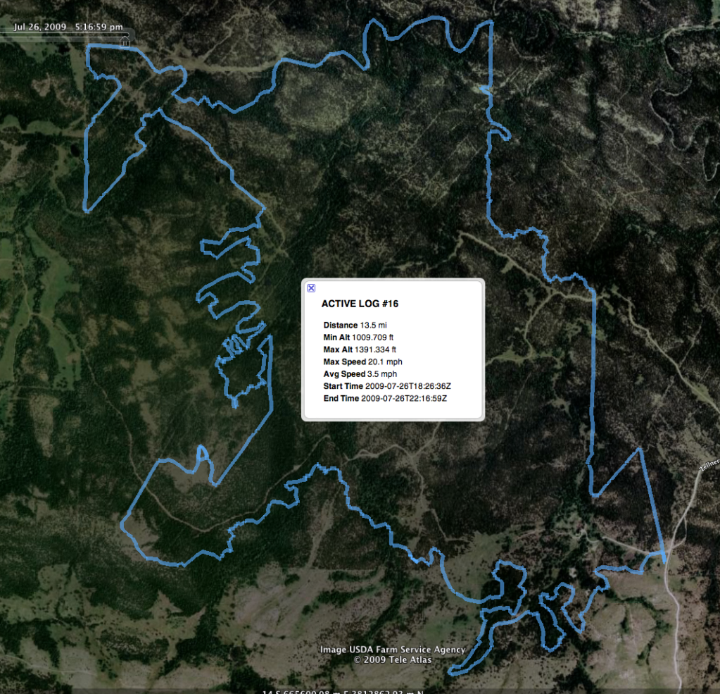
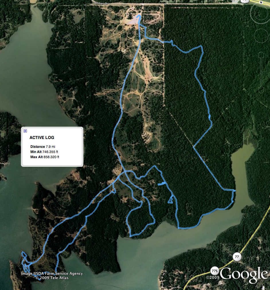
Closest trails near OKC as far as I know are Cross Bar Ranch near Davis and Lake Murray. Here are my GPS maps from my rides a few years ago...
Nice maps...what are you using to record your tracks?
Nice maps...what are you using to record your tracks?
Google Earth's GPS Import Tool. I have an old Garmin GPSMap 60 attached to the handlebar of my ATV. I simply connect it via USB to my Mac (pc works too) and the GPS Import Tool sucks in the waypoints, routes, and tracks. Nothing beats free. Easy-Peasy-Lemon-Squeezy.
Google Earth's GPS Import Tool. I have an old Garmin GPSMap 60 attached to the handlebar of my ATV. I simply connect it via USB to my Mac (pc works too) and the GPS Import Tool sucks in the waypoints, routes, and tracks. Nothing beats free. Easy-Peasy-Lemon-Squeezy.
I've imported tracks and waypoints before. I was just wondering what you were using to capture them. I've used my iPhone 4 to create a couple tracks before...I wonder if a dedicated GPS unit would be more accurate than using a smartphone. I've got a droid phone now, but haven't tried it out yet...
Similar threads
- Replies
- 21
- Views
- 1K
- Replies
- 34
- Views
- 1K
Latest posts
-
-
-
-
-
-
-
-
-
-
-
Looking like I might have a bumper crop of berries this year.
- Latest: dennishoddy
-
-
-
-
-
-
-
Join the conversation!
Join today and get all the highlights of this community direct to your inbox. It's FREE!
- Curated content sent daily, so you get what's interesting to you!
- No ads, no large blocks of text, just highlights for easy digest
- It's all totally free!
Enter your email address to join:
Thank you for joining!
Already
a member? Click here to log in


